Todos los santos lake
Todos los Santos Lake
- Photo Friendly
- 10 Hours
- 1-10 People
- All weather
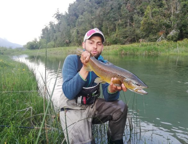
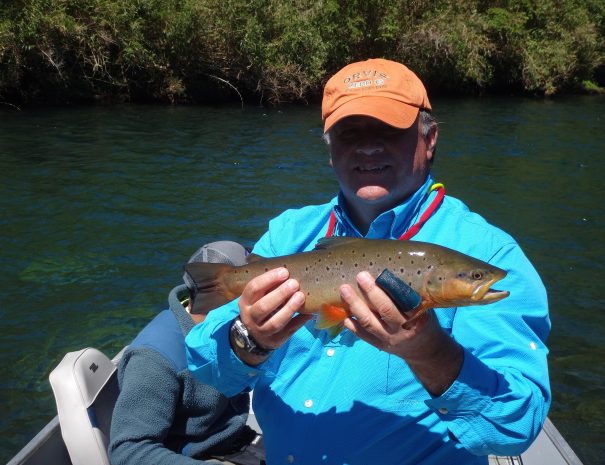
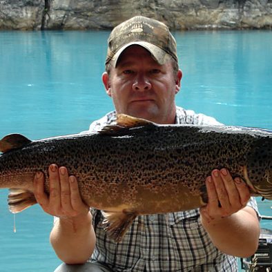
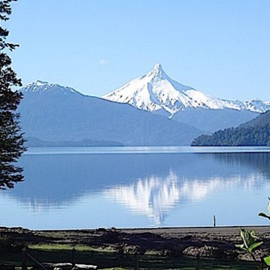
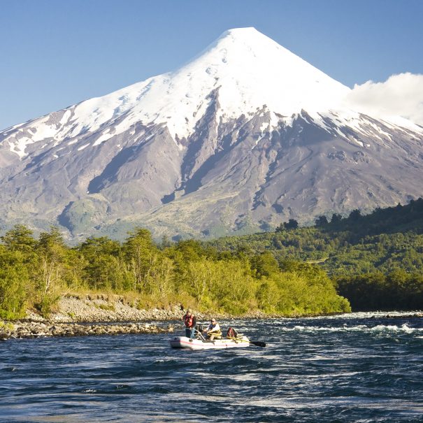
It is located in the X Region of Los Lagos, Chile, 96 km northeast of the regional capital Puerto Montt and 76 km east of the city of Puerto Varas, within the confines of the Vicente Pérez Rosales National Park. It has an area of 178.5 km2, an altitude of 189 meters above sea level and a maximum depth of 337 meters. The lake has been considered as the northern limit of Chilean Patagonia, but currently it is also usually extended north to the height of Valdivia. The tributary basin of the lake comprises 3036 km2. The main tributary is the Peulla River / Negro River; These two rivers converge and flow jointly into the lake in the town of Peulla. The Peulla River drains the northern flank of Cerro Tronador, while the Negro River drains a long valley that runs north-south. The second most important tributary is the Blanco River, which drains the southern flank of the Tronador. The lake drainage is located in the town of Petrohué where it originates the Petrohué River, with an average flow in that section of about 270 m3 per second. A short distance from Petrohué, the Petrohué River passes the Petrohué Falls. The intense precipitations in the tributary basin of the lake cause variations of level of the order of 3 meters. These strong variations in level give a distinctive appearance to the lake's shoreline. A regular lake navigation service on this lake represents a link in the "route of the lakes" that connects Puerto Montt / Puerto Varas in Chile with San Carlos de Bariloche on Lake Nahuel Huapi in Argentina. Lake Todos los Santos has two main ports: Petrohué at its western end and the village of Peulla at the eastern end; both towns have tourist services. There is no land route that connects these two places. The lake is surrounded by steep hills that leave room for few small plains. Three snow-capped mountains stand out: the Osorno volcano to the west, the Puntiagudo volcano to the north, and the Tronador to the east. The forests that cover the slopes belong to the type called Valdivian Jungle, in its Andean variety. The frequent and most visible tree species are: coihue (Nothofagus dombeyi) and glanders or ulmo (Eucryphia cordifolia). This lake has many bays and extensive beaches surrounded by cattails, which makes it an ideal and perfect place for fly fishing. The most common catches are Rainbow Trout, lighthouses and in some very specific places we can find the coveted Fontinalis or Brooks. Important: Fishing rental equipment $ 40.000 (rods, reels, wader, wading shoes) --- Se encuentra ubicado en la X Región de Los Lagos, Chile, a 96 km al noreste de la capital regional Puerto Montt y 76 km al este de la ciudad de Puerto Varas, dentro de los límites del Parque Nacional Vicente Pérez Rosales. Tiene una superficie de 178,5 km2, una altitud de 189 metros sobre el nivel del mar y una profundidad máxima de 337 metros. El lago ha sido considerado como el límite norte de la Patagonia chilena, pero actualmente también suele extenderse hacia el norte hasta la altura de Valdivia. La cuenca tributaria del lago comprende 3036 km2. El principal afluente es el Río Peulla / Río Negro; Estos dos ríos convergen y desembocan juntos en el lago del pueblo de Peulla. El río Peulla drena el flanco norte del Cerro Tronador, mientras que el río Negro drena un largo valle que corre de norte a sur. El segundo afluente en importancia es el río Blanco, que drena el flanco sur del Tronador. El desagüe del lago está ubicado en la localidad de Petrohué donde nace el río Petrohué, con un caudal promedio en ese tramo de unos 270 m3 por segundo. A poca distancia de Petrohué, el río Petrohué pasa por los Saltos de Petrohué. Las intensas precipitaciones en la cuenca tributaria del lago provocan variaciones de nivel del orden de los 3 metros. Estas fuertes variaciones de nivel dan un aspecto distintivo a la orilla del lago. Un servicio regular de navegación lacustre en este lago representa un eslabón en la "ruta de los lagos" que conecta Puerto Montt / Puerto Varas en Chile con San Carlos de Bariloche en el lago Nahuel Huapi en Argentina. El lago Todos los Santos tiene dos puertos principales: Petrohué en su extremo occidental y el pueblo de Peulla en el extremo oriental; Ambos pueblos cuentan con servicios turísticos. No existe una ruta terrestre que conecte estos dos lugares. El lago está rodeado de empinadas colinas que dejan espacio para unas pequeñas planicies. Destacan tres nevados: el volcán Osorno al oeste, el volcán Puntiagudo al norte y el Tronador al este. Los bosques que cubren las laderas pertenecen al tipo denominado Selva Valdiviana, en su variedad andina. Las especies arbóreas más frecuentes y visibles son: el coihue (Nothofagus dombeyi) y el muermo o ulmo (Eucryphia cordifolia). Este lago tiene muchas bahías y extensas playas rodeadas de espadañas, lo que lo convierte en un lugar ideal y perfecto para la pesca con mosca. Las capturas más habituales son la Trucha Arcoiris, los faros y en algunos lugares muy concretos podemos encontrar las codiciadas Fontinalis o Brooks. Importante: Renta de equipo de pesca $ 40.000 (cañas, carretes, wader, zapatos de vadeo)


Lunch included
Lunch, wine and beer.
Family Friendly
Enjoy with family.
Professional Guide
Guide for two people and boat.
Transport included
Transport from Puerto Varas
Tour Pricing
- Transport from Puerto Varas
- lunch wine and beer
- guide for two people
- boat for the trip.
- Important: Fishing rental equipment $40.000 CLP (rods, reels, wader, wading shoes)
$350.000CLP
-per day
(2 person per day)
Have a Question?
Feel free to reach out and we're happy to answer any questions you may have.

Leave a Reply